

Registrations Closed
This course provides an opportunity for early career researchers to gain practical, hands-on experience with spatial data, tools, and techniques. Led by an expert team of faculty from the IIHS Geospatial Lab, this course is structured around a workshop-based format that emphasises active hands-on learning for practical applications. Participants will gain an introductory understanding of various concepts related to GIS and Remote Sensing, as well as working with spatial data, open-source tools and services. By the end of the course, participants will possess both a practical skill set and the confidence necessary to apply geospatial analysis effectively to diverse research projects. During the course, participants will have the opportunity to delve into various key questions related to geospatial data and technology. These questions will include but are not limited to:
- What is meant by Spatial Thinking and why is it important?
- What is GIS and Remote Sensing, and how are they used in research and decision making?
- How can one get started on working with spatial data, including data collection, storage, and analysis?
- What are some of the techniques and tools that can be used to create maps and other visualisations from geospatial data?
- How to explore, query and integrate multiple spatial data variables to arrive at decisions, and build scenarios?
By exploring these questions in a hands-on and practical way, participants will gain a comprehensive understanding of geospatial data and technology, and be better equipped to apply these concepts to their research projects.
Who this is for
- Early career researchers
- Master’s students who would like to develop GIS skills
This course will enable participants to:
- Convert conventional tabular data into spatial data, facilitating more effective analysis and visualisation
- Create maps using openly available and self-created data, allowing them to communicate research findings more effectively
- Appreciate the importance of spatial concepts in academic research, and be better equipped to use these concepts in their work
- Utilise a variety of open-source GIS tools and services, providing them with a range of options for data analysis and visualisation
- Identify spatial solutions to real world problems, demonstrating their ability to apply geospatial data and technology to practical challenges
- Interpret spatial data and maps to extract meaningful insights, allowing them to draw more accurate and useful conclusions from their research
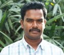
Amruth is an ardent technology enthusiast with diverse interests that include Big Earth Observation (EO) data, cloud computing, UI/ UX development, spatial data management, and integrating computer science with remote sensing and GIS. He is part of the faculty that teaches GIS and Survey Design in the IIHS Urban Fellows Programme, covering both foundational and advanced coursework. In the past, Amruth has worked at the Institute of Trans-Disciplinary Health Sciences and Technology in Bengaluru, where he developed mobile applications in the field of GIS and primary healthcare. Amruth’s academic qualifications include a Master’s degree in Remote Sensing and GIS, with a specialisation in Geoinformatics, from the Indian Institute of Remote Sensing in Dehradun.

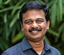
Dhananjayan has over 10 years of professional experience on projects such as Monitoring Global Urban Expansion, Land Use/ Land Cover Classification, and Geographic Information System (GIS) based slum inventory mapping. He provides Geospatial analysis support to Research and Practice projects and is part of the teaching team that conducts GIS courses for the IIHS Urban Practitioners Programme and the IIHS Urban Fellows Programme. He holds a Master’s degree in Remote Sensing from Anna University, Chennai.
 Kiran Mathramkot Chandrasekharan
Kiran is a remote sensing researcher and analyst with more than two decades of experience in the applications of geospatial technologies in environmental conservation and agriculture management. He has taken the lead in remote sensing-based spatial analysis for a range of interdisciplinary studies including assessing the trends and patterns in natural and agricultural landscapes, land suitability analysis and resource use of marginalised communities at multiple spatial scales. He works in the IIHS Geospatial Lab. In the past, he has worked with International Water Management Institute (IWMI), Colombo and Ashoka Trust for Research in Ecology and the Environment (ATREE), Bangalore. Kiran has been involved in teaching GIS and remote sensing short courses for PhD and postgraduate students and professionals.
Lokesh has over a decade of professional expertise in the field of GIS and data creation. At IIHS, he is involved in constructing the GeoData Library of India while simultaneously assisting with various research and practical Geospatial dataset-related projects. He is also part of the teaching team in the IIHS Urban Practitioners’ Programme and the IIHS Urban Fellows Programme, offering courses on Maps, Google Earth, and QGIS.
In the past, Lokesh has undertaken the development of Geodatabases for buildings, transportation networks, land use classes, and natural resources for multiple cities in India, China, North America and Saudi Arabia, using LiDAR dataset, Orthophotos, DEMs, and satellite images.
Programme Structure
- Delivered through a combination of online lectures and extensive hands-on workshops
- A high degree of emphasis on developing a strong foundation in GIS concepts and mastering visualisation and analysis techniques using open-source GIS tools and services
Key Differentiators
- Familiarise with a diverse set of spatial analytical tools and techniques
- Concepts, discussions, examples, and methods rooted in the Indian context
- Hands-on activities to enable immediate application
Programme Details
- Format: Online
- Dates: 26 and 27 July, 2 and 3 August 2024
- Fees: Rs.7,500/- + 18% GST
- Maximum cohort size: 25
For more information, get in touch at upp@iihs.ac.in or on 9611911169
Hardware and Software Prerequisites
- Computer with at least 4GB of memory (RAM) and upwards of Intel i5 generation of CPUs and/ or AMD equivalent; tablets/ touch screens will not be suitable
- Windows 8 and above, MacOS High Sierra (10.13) and above, any Linux flavour with latest updates
Week 1
| Friday, 26 July 2024 | |
| 2:00 pm – 3:30 pm | Spatial Thinking and Introduction to GIS |
| 4:00 pm – 5:30 pm | Open GIS Platforms |
| Saturday, 27 July 2024 | |
| 10:00 am – 11:30 am | Introduction to QGIS and Map Making |
| 12:00 pm – 1:30 pm |
|
Week 2
| Friday, 2 August 2024 | |
| 2:00 pm – 3:30 pm | Spatial Data and Query Building |
| 4:00 pm – 5:30 pm | Working with Digital Elevation Model |
| Saturday, 3 August 2024 | |
| 10:00 am – 11:30 am | Site Suitability Analysis |
| 12:00 pm – 1:30 pm | Introduction to Remote Sensing |
<< Back


